A Picture is Worth 10,000 Words...
GEOTERREN specializes in high quality graphics produced in Adobe Illustrator for use in reports, public presentations, and expert witness demonstratives. Our services combine scientific expertise in geology, hydrogeology, and environmental data interpretation, with graphic design.
Illustrations include Conceptual Site Models (CSMs), geologic cross-sections, base maps, etc. We incorporate boring log data, Membrane Interface Probe (MIP) data, water levels, and chemical concentrations into specialized illustrations that target your subsurface areas of concern.
Illustrations include Conceptual Site Models (CSMs), geologic cross-sections, base maps, etc. We incorporate boring log data, Membrane Interface Probe (MIP) data, water levels, and chemical concentrations into specialized illustrations that target your subsurface areas of concern.
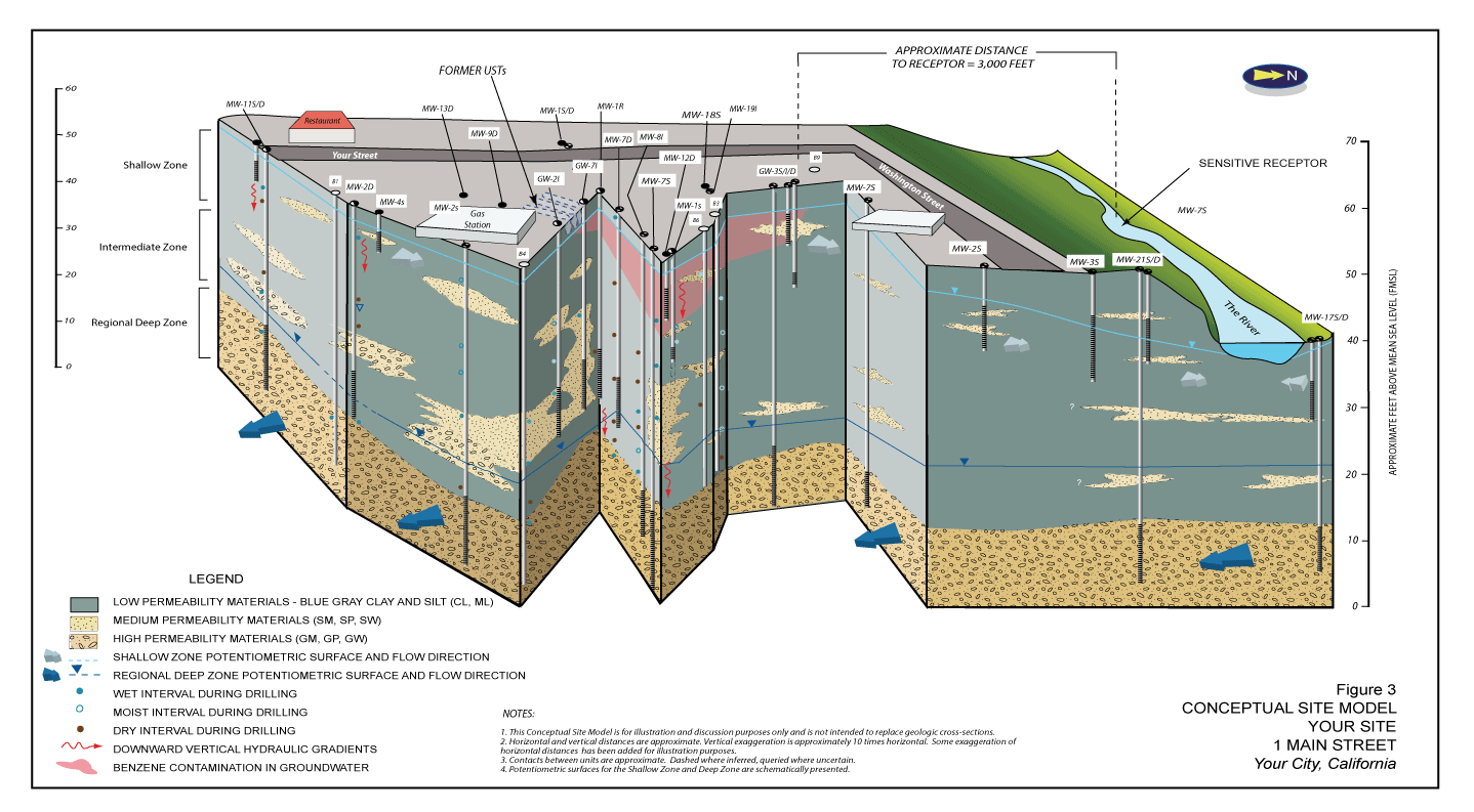
Conceptual Site Model illustrating groundwater flow at 90 degrees between shallow local hydrogeologic unit and deeper regional flow. CSM used in report to regulatory agency to illustrate flow conditions relative to distribution of benzene in groundwater.
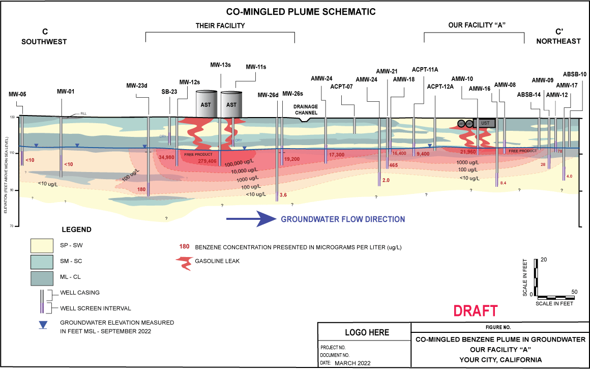
Geologic Cross-Section illustrating vertical extent of contamination in groundwater along flow path. Illustration used in regulatory agency meeting demonstratives and report.
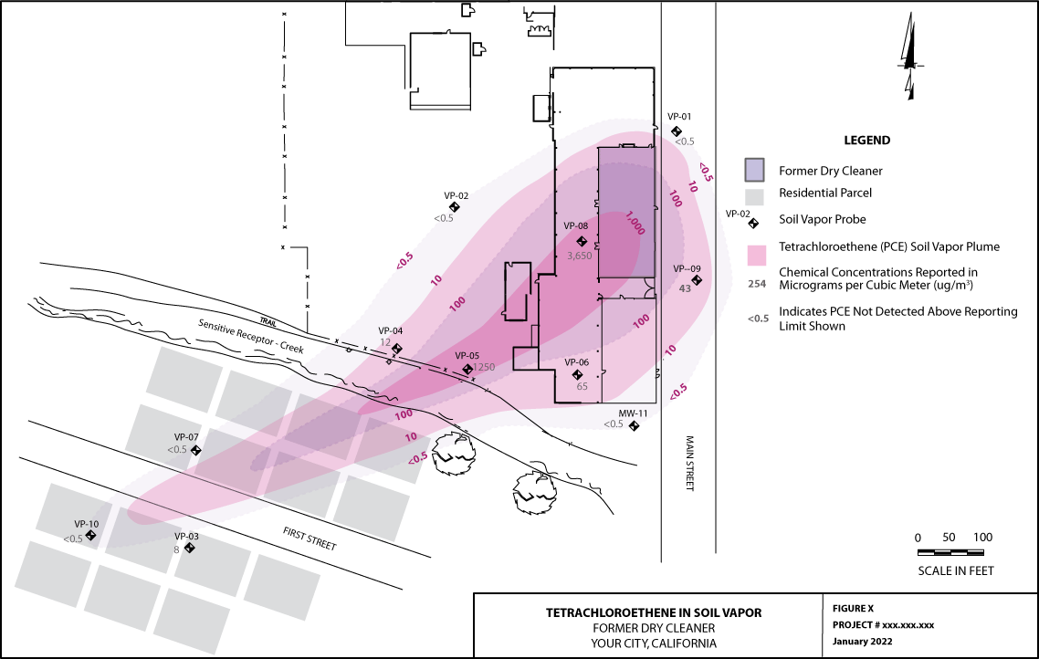
Soil Vapor Contamination Map showing extent of total chlorinated volatile organic compounds at former window manufacturing site. Illustration used in technical reports and meetings with the State Water Resources Control Board and the Regional Water Quality Control Board.
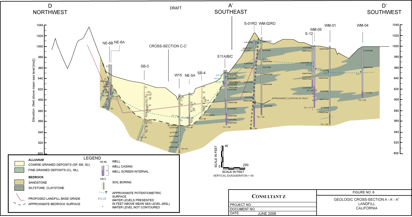
Geologic Cross-Section of landfill site with complex subsurface geology.
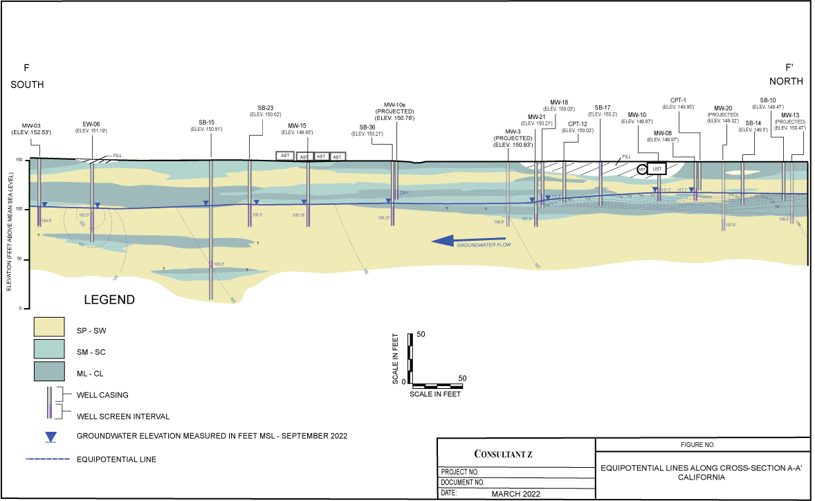
Geologic Cross-Section - Equipotential Lines showing direction of groundwater flow.
GEOTERRENEnvironmental Services - Experienced and Expeditious - providing you the best possible product, on time and on budget.
Site powered by Weebly. Managed by iPage

